
ポスターについて
販売:
このデザインについて
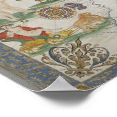
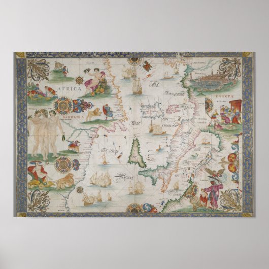
Old fashioned Mediterranean sea map ポスター
This is and old map of Mediterranean sea, also known as "Portulan" Portolan charts are navigational maps based on compass directions and estimated distances observed by the pilots at sea. They were first made in the 13th century in Italy and later in Spain. With the advent of the Age of Discovery, they were considered State secrets in Portugal and Spain. They were very valuable in the description of Atlantic and Indian coastlines for newcomer English and Dutch raiding, and later trading, ships. The word portolan comes from the Italian adjective portolano, meaning "related to ports or harbours."
カスタマーレビュー
5つ星評価のうち星4.7全レビュー数 41
レビュー:41
類似商品のレビュー
5つ星評価のうち星5.0
5つ星評価のうち星5 k.2024年3月11日 • 認証済みのご注文
ポスター、サイズ: 40.64cm x 30.48cm, ハードウェア: なし, フレーム: なし, メディア: スタンダード(セミグロス), マット: なし,
とても綺麗に仕上がりました。思ったように印刷されています。 パソコンデータとほとんど変わりなくカラーも再現されて細部も綺麗に印刷されていました。
5つ星評価のうち星5.0
5つ星評価のうち星5 k.2024年3月11日 • 認証済みのご注文
ポスター、サイズ: 40.64cm x 30.48cm, ハードウェア: なし, フレーム: なし, メディア: スタンダード(セミグロス), マット: なし,
とても綺麗に印刷されていました。用意した額に入れて飾っています。 カラーについても鮮やかに印刷されていてよかったです。ありがとうございました。
5つ星評価のうち星5.0
5つ星評価のうち星5 k.2024年3月11日 • 認証済みのご注文
ポスター、サイズ: 40.64cm x 30.48cm, ハードウェア: なし, フレーム: なし, メディア: スタンダード(セミグロス), マット: なし,
鮮やかなカラーも再現されていてとてもよく仕上がっていました。
用意した額に飾っています。 カラーも綺麗に再現されプリントも綺麗でした。満足の仕上がりです。
タグ
その他の情報
商品 ID: 228181638238578654
出品日: 2012/3/1 15:21
レーティング: G