ラゲッジタグについて
販売:
このデザインについて
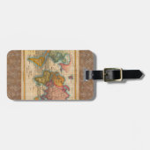
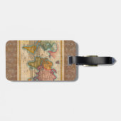
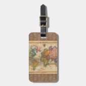
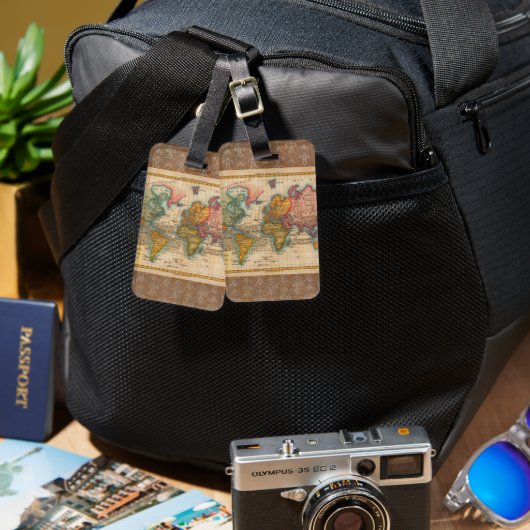
World Map 1700s Antique Continents ラゲッジタグ
World Map from the 1700s -- the Planisphere A highly colorful world map from the 1700s, this world map print is from an authentic map originally published in 1780. It shows the world in vibrant full color. The world map continents are quite well rendered for being drawn 250 years ago. This beautiful world map's illustrator drew North America in green. Central and South America are in a bright yellow, Africa is a dark green, Europe and Australia in orange, and Asia and Greenland in pink. Beautifully rendered, this world map is a gorgeous image from a time when map making was an art. About "The Planisphere" world map image- The actual title of the image is "Planisphere Suivant la Projection de Mercator", published in Paris by M. Bonne in 1780. The Planisphere world map was originally printed as a copper engraving, and later hand colored in outline and wash.

カスタマーレビュー
5つ星評価のうち星5.0全レビュー数 5
レビュー:5
類似商品のレビュー
5つ星評価のうち星5
y.2015年2月4日 • 認証済みのご注文
アクリルラゲッジタグ
Zazzleレビュープログラム
手元に届いて、大変良く出来上がっていて、とても嬉しいです。
作りもイラストもとても綺麗で予想以上で気に入りました。
ゴルフバッグ用に注文しましたが、又、違うイラストで欲しくなってしまいました。
ありがとうございました。 大満足です。 画像の品質もとてもよいです。
皆さんにお勧めしたいです。
ちょっとしたプレゼントにも喜ばれると思います。
5つ星評価のうち星5
りんご2021年6月13日 • 認証済みのご注文
アクリルラゲッジタグ
Zazzleレビュープログラム
オシャレでイメージ通り、早く届きました。 綺麗に印刷されていました。
ゴルフ用に買いましたが、プレゼントに良さそうです。
5つ星評価のうち星5
A.2018年5月18日 • 認証済みのご注文
アクリルラゲッジタグ
Zazzleレビュープログラム
High quality & beautiful! This is exactly what I wanted!
タグ
その他の情報
商品 ID: 256027334635430863
出品日: 2026/1/17 7:20
レーティング: G
最近閲覧された商品