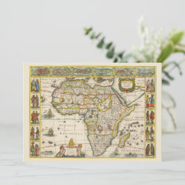
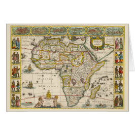
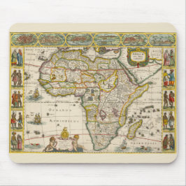
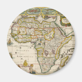
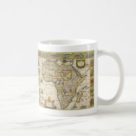
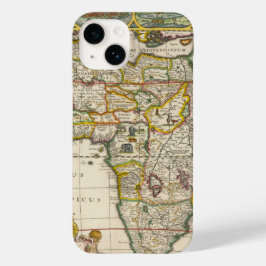
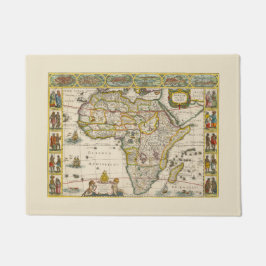
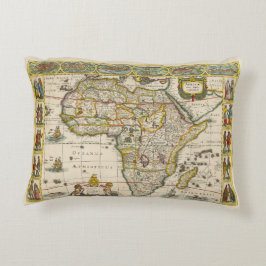
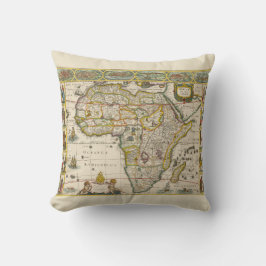
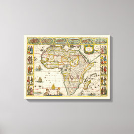
Antique Map of Africa by Hondius and Jansson
Vintage illustration antique map of the continent of Africa by Henricus Hondius and Jan Jansson, 1635. Africae nova Tabula.
This map is filled with fictitious rivers and mountains with the origin of the Nile conforming to the Ptolemaic tradition of twin lakes located below the equator. The Kingdom of Monomotapa fills the entire southern tip of Africa which is now shown as more rounded. The oceans have ships, flying fish and sea monsters, while elephants, lions, zebras, ostriches and other exotic animals are on land. The border includes insets with 10 sets of costumed figures, representing the indigenous peoples of Africa and six city views along the top. The cartouche features a clock with Roman numerals and a bell, the face of the clock is a skull surrounded by the rays of the sun. More designs and products available, please browse my store and email special requests to masterpiececafe@gmail.com
結果:25 件

アンティークアフリカの地図Hondius and Jansson
売値 ¥600. 元値 ¥666.
ホンディウスとヤンソンのアフリカ古地図 マウスパッド
価格¥2,150
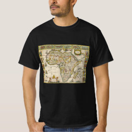
ホンディウスとヤンソンの古地図アフリカ図 Tシャツ
価格¥3,618
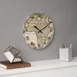
ホンディウスとヤンソンのアフリカ古地図 ラージ壁時計
価格¥8,225
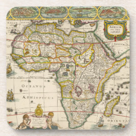
ホンディウスとヤンソンの古地図アフリカ図 コースター
価格¥5,000
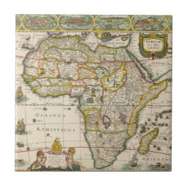
ホンディウスとヤンソンの古地図アフリカ図 タイル
価格¥2,425
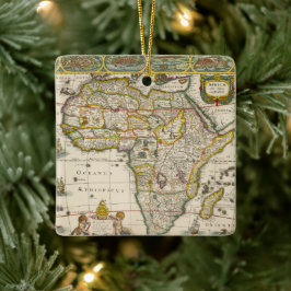
ホンディウスとヤンソンのアフリカ古地図 セラミックオーナメント
価格¥3,075
ホンディウスとヤンソンのアフリカ古地図 マグネット
価格¥1,113
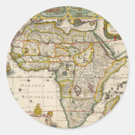
ホンディウスとヤンソンのアフリカ古地図 ラウンドシール
価格¥2,250
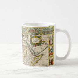
ホンディウスとヤンソンのアフリカ古地図 コーヒーマグカップ
価格¥2,975
ホンディウスとヤンソンによるアフリカの古地図 コーヒーマグカップ
価格¥2,975
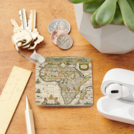
ホンディウスとヤンソンの古地図アフリカ図 キーホルダー
価格¥2,650
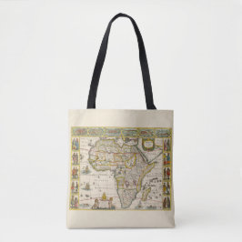
ホンディウスとヤンソンの古地図アフリカ図 トートバッグ
価格¥6,500
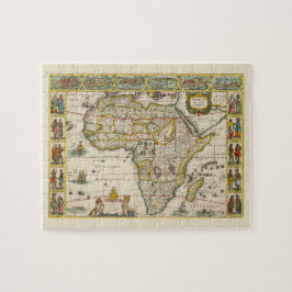
ホンディウスとヤンソンのアフリカ古地図 ジグソーパズル
価格¥3,300
ホンディウスとヤンソンの古地図アフリカ図 ドアマット
価格¥6,466
ホンディウスとヤンソンの古地図アフリカ図 アクセントクッション
価格¥9,225
ホンディウスとヤンソンのアフリカ古地図 クッション
価格¥9,275
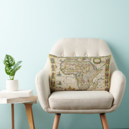
ホンディウスとヤンソンの古地図アフリカ図 ランバークッション
価格¥10,450
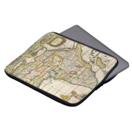
ホンディウスとヤンソンのアフリカ古地図 ラップトップスリーブ
価格¥5,000
ホンディウスとヤンソンのアフリカ古地図 キャンバスプリント
価格¥14,600
YesterdayCafeのその他の注目コレクション