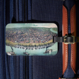
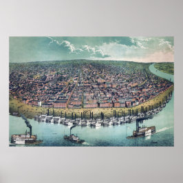
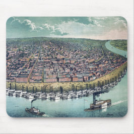
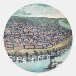
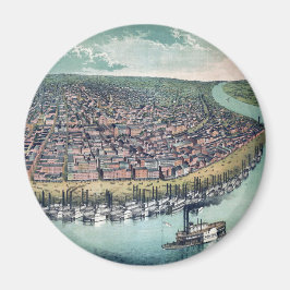
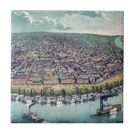
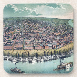
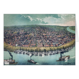
Antique Map of Saint Louis, Missouri, 1859
Vintage illustration bird's eye view of the streets of Saint Louis on the Mississippi River in 1859. St. Louis is a major U.S. port in the state of Missouri and is built along the western bank of the Mississippi River, on the border with Illinois. St. Louis was founded in 1764 by French fur traders Pierre Laclède and Auguste Chouteau, and named after Louis IX of France. Louis IX, aka Saint Louis, was King of France from 1226 until his death in 1270. More designs and products available, please browse my store and email special requests to masterpiececafe@gmail.com
結果:26 件


1859年のセントルイス(ミズーリ州)の古地図 ジグソーパズル
価格¥3,300
古地図 セントルイス ミズーリ州 ミシシッピ川 マウスパッド
価格¥2,150


アンティーク地図 セントルイス ミズーリ州 ミシシッピ川 タイル
価格¥2,425


アンティーク地図 セントルイス ミズーリ州 ミシシッピ川
売値 ¥600. 元値 ¥666.


YesterdayCafeのその他の注目コレクション