


カードについて
販売:
このデザインについて
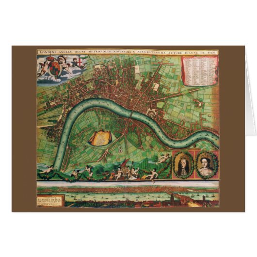
17 Century Antique London Street Map
Vintage illustration antique map of London, England by Johannes de Ram, 1689. Londini Angliae Regni Metropolis Delineatio Novissima & Accuratissima Autore Ioanne De Ram. United Kingdom, Great Britain.
The map includes a 10 point key in the top left corner bearing the names of Southwark landmarks, and a 148 point key in the top-right with the names of locations on the other side of the Thames River. The smaller title contained in a classical cartouche; the arms of London with dragon supporters. The bottom right has portraits of William and Mary, along the bottom is a view of London and the Thames River shortly after the fire. The map celebrates King William III and Queen Mary II's ascent to the English throne after the Glorious Revolution giving the country a Dutch monarch.

カスタマーレビュー
この商品についてのレビューは、まだありません。この商品を購入しましたか?
タグ
その他の情報
商品 ID: 137655123455703123
出品日: 2018/11/12 2:08
レーティング: G