

ネクタイについて
販売:
このデザインについて
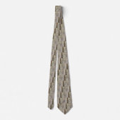
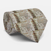
Antique Old World Map of Africa, c. 1635 ネクタイ
Vintage illustration antique world map featuring the continent of Africa and the island of Madagascar. By cartographer Willem Jansz Blaeu (1571-1638) in c. 1635. Willem Janszoon Blaeu was a Dutch cartographer, atlas maker and publisher. The Atlantic and Indian Oceans have ships sailing the seas to travel and navigate the globe. Surrounding this international African chart are people dressed in native costumes and along the top edge are smaller city maps.

カスタマーレビュー
5つ星評価のうち星4.1全レビュー数 24
レビュー:24
類似商品のレビュー
5つ星評価のうち星5.0
5つ星評価のうち星5やすべぇ2022年11月8日 • 認証済みのご注文
ネクタイ
Zazzleレビュープログラム
健康診断のネタになったので良かったです。 表面はきれいにプリントされていましたが、折り返し部分にも5ミリ程度色がついていると、ネクタイを締めた部分に白い線が出なくていいと思いました。
5つ星評価のうち星4.0
5つ星評価のうち星4Chiaki I.2023年4月5日 • 認証済みのご注文
ネクタイ
Zazzleレビュープログラム
スムーズに届きました!
思っていたデザインの物がありすぐ購入しました! 作りが表面のみの印刷なので裏の白い部分が少し気になりましたが許容範囲です。
5つ星評価のうち星5.0
5つ星評価のうち星5 k.2024年3月11日 • 認証済みのご注文
ネクタイ
縫製もしっかりしていました。
モスクに着けて行ったらたくさんの人からどこで買ったの?と声をかけられました。 細かいところまで、しっかり印刷されており満足しました。
タグ
その他の情報
商品 ID: 151819457320196929
出品日: 2010/11/24 14:37
レーティング: G